|
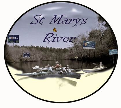
Borderline Tour Feb 16 – 23, 2023
We’ve
had the St Marys River on our RADAR for a while. This year we had the chance to do it. We decided to start at St Marys Cove due to
ease of logistics. The St Marys River
defines the borders of Florida and Georgia, thus our name for this trip:
“Borderline Tour.” |
||||
|
|
||||
|
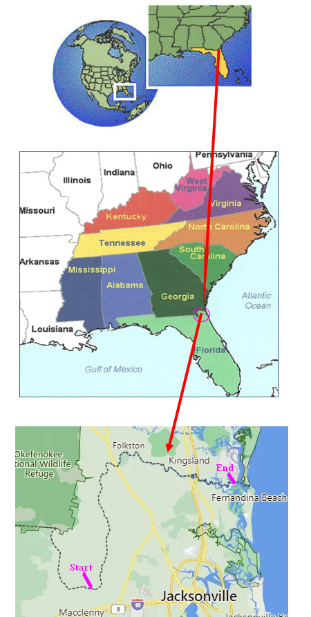
Map of Route
|
||||
|
|
||||
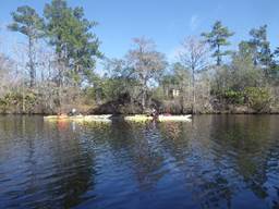
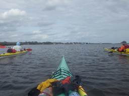
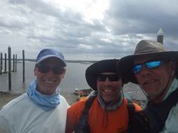
Paddlers: Craig, Stew, Dave Sea
Kayaks and by coincidence all Current Designs Solstice of
varying years: 2017, 2010, 1999 – same order as paddlers Trip
Conditions: Temps mostly low
to mid 70s daytime; nights nice in the 50s and 60s. The second day it rained around 2 pm but by
5 it was clear and a cold front came through.
It got down to 29 the next morning but warmed up quickly and we had
warmer days in the 70s again. Meals: We each brought our own meals – everything
from canned soup, ramen noodles, Knorr pasta dinners, MRIs and packaged
chicken/tuna. Power bars, snacks,
bagels, and peanut butter for lunch; coffee, oatmeal, granola and fruit cups
for breakfast Snacks: nutrition bars, beef jerky, apples,
oranges. Water: We each had a gallon for
each day. Some in 16.9 oz bottles,
some gallon containers. Beer: Yes.
We had a dry bag attached to the top back of Dave’s kayak that
supported a 12 pack and ice. |
||||
We watched the water levels and were told by locals the water was
just high enough to get through with kayaks – that was at 3.2 feet. It can be very shallow and require a lot of pulling and portaging at lower
levels. We felt the water level was
just right with 4.2 feet at St. Marys River Near Macclenny, FL as reported by the USGS website. We also used the NOAA website: National Weather
Service Advanced Hydrologic Prediction Service to
monitor river levels.
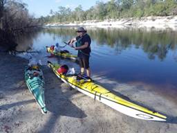
|
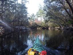
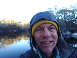
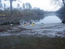
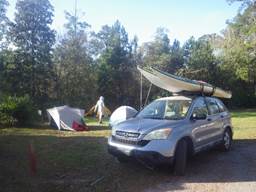
Preparing to launch at St Marys Cove |
|||
|
|
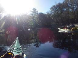
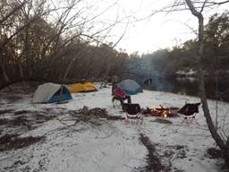
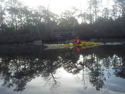
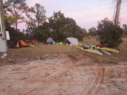
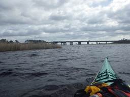
Day 1
– 3 miles, Feb 16, 2023 St
Marys Cove was a great place to begin.
Brian, the owner, let us leave a vehicle there for part of our trip
for a nominal fee. He was full of good
information about the river and cautioned us it was pretty low at the time. We
arrived around noon – Stew and Dave from South Florida east coast and Craig
from Virginia. We unloaded our
vehicles and packed our kayaks then Craig and Dave shuttled a vehicle to St
Marys River Campground where we had reservations for our fourth night. That is around 55 miles from our
start. They made it back to St Marys
Cove and we launched at 3:45 pm. We had
planned to camp at St Marys Cove but they don’t have tent camping so we
decided to get a few miles in and paddled just over 3 miles downriver to get
past river homes and found a nice sandbar at 4:30pm. Pretty
river and we were excited to start our trip.
It was actually good to launch and get a few miles in just to be on
our way. Our paddling buddy Sam
couldn’t make it this year. He is an
integral part of our group and we sorely missed
him. We always relied on him to make
our nightly fires. He saw my post on
Facebook and was impressed we could actually make a nice fire! We had
bought subs for dinner so that we wouldn’t be stressed the first night with
all the shuffling we did. That was a
good idea. We also had beer! That
night had very pleasant temperature for camping. We heard owls and dogs barking in the distance
as we drifted off to sleep. |
|||
|
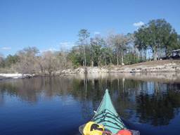
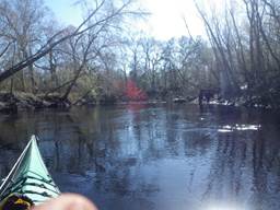
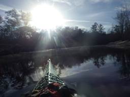
Day 2
– 18 miles, Feb 17, 2023 We had
known that it was forecast to have heavy rain today and a cold front was
coming through. We decided an early
start would be good so we could find a campsite before the rain. So, we were up at 6am, have coffee and
breakfast, but it took a long time to get going (we blame Craig 😊) and
we’re off at 7:30am. The
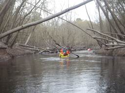
river is beautiful as we had expected with a 2mph flow. As we paddled, we saw lots of birds
including eagles, osprey, and buzzards.
We didn’t see any furry wildlife except a squirrel
here and there. Our
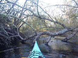
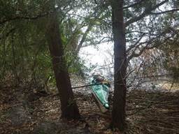
kayaks are sea kayaks, almost 18 feet long so they are a little difficult to
maneuver on narrow rivers and especially through downfall. Dave
almost went under trying to go under a downed tree because of the current
pushing him and he misjudged how low the tree was. We always watch the first guy go through
downfall before deciding to follow or say “That didn’t look too good.” and
choosing a different route. No one
followed Dave this time… Lots
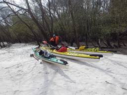
of sandbars today and we stopped every hour to stretch our legs. Making mandatory stops every hour helps
everyone to relax and makes the long days more enjoyable. We encountered a good amount of downfall
and took turns going first so the others could choose more wisely. We
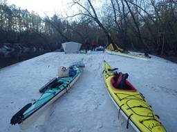
pulled out at around 1pm because we knew the rain was approaching. Quickly made camp on a very white
sandbar. Someone asked if we were
camping in snow when they saw the photo on Facebook. The
rain started around 2pm and lasted 3 hours.
It got very windy and the rain pounded our tents. Then, it cleared up and got cold. We were not looking forward to getting up
the next morning in the cold and damp. |
Don’t follow Dave!
Is that snow? |
|||
|
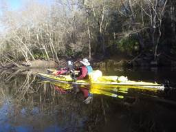
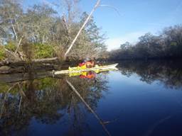
Day 3
– 19 miles, Feb 18, 2023 As it
turned out, it was dang cold on the river at 29 degrees in the morning but our tents were dry due to the low humidity
after the cold front. Nice to pack up
a dry tent although we all took lots of the fine
sand with us. Of great
concern was Dave awoke and the right side of his face didn’t work! He wasn’t sure what was going on – he never
had any medical issues and was rarely sick.
We all went through the possibilities and stroke was right up
there. We had no cell phone coverage
and had 34 miles down river to the next take
out. We talked about it and Dave
decided to just go on with the paddle plan because he didn’t show any other
signs of a stroke like numbness to the legs or arms or one side of the body. WE DO NOT recommend others do this. Always get medical attention. More about this later. We launch at 8:38am and everyone agreed that Dave should wear
his life preserver today. He would
have anyway due to it being so cold!
Then there was some banter of who would get his stuff if he dies and
he said to give him a Viking send off- make a pyre of him and his kayak and
set him afloat. Funny but his
condition was very concerning especially for him – he kept wondering what the
heck was going on… We
encountered more downfall and had to portage our heavily loaded kayaks two
times today. This would not be
suitable for a novice without some experienced paddlers along. The scenery was still beautiful with the
downfall making the paddling more interesting and at times a little too
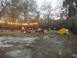
intense. We even saw some fall colors. At 3pm
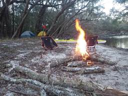
we found a suitable sandbar to camp on and made a fire. We each made our dinners using our camp
stoves and settled around the fire for a nice evening. We still had beer and enjoyed drinking it
while the sun went down. That night
was very nice and once again we hear owls hooting as
we lay in our tents. We
discussed Dave’s situation and figured he must have Bell’s Palsy since he
didn’t die or have other issues. That
made him feel a lot better because all he could think about was that he may
have had a stroke. As it turns out, he
did have Bell’s Palsy and as I’m writing this, one month later, I am still
recovering and almost there. |
Dave’s right side of face starting to become paralyzed
Fall colors!
Another great campsite |
|||
|
|
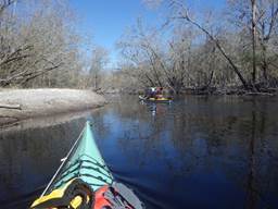
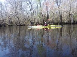
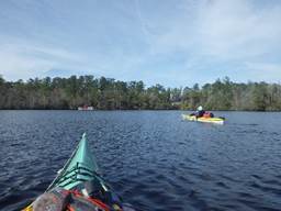
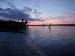
Day 4
– 15 miles, Feb 19, 2023 We get
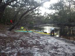
up kind of leisurely at 7am – we are early risers and 7 is late for us. There is a fog hovering over the water –
always neat to see when we are camping on a river. Paddling
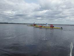
is nice and therapuetic and the scenery still superb. We thought the river was a little wider and
we wouldn’t encounter downfall today but we were wrong. Hey, it adds interest to the paddle and we
actually enjoyed most of it – there was just enough to keep us on our toes. We
noticed that the sandbars are fewer as we progress and wonder what will
happen tomorrow as we get closer to the coast. We know sandbars will be gone and marsh
will prevail but that’s tomorrow. We make
it to St Marys Fishcamp (at Scott’s Landing) where we had prearranged to
leave a vehicle and to camp there.
Once there, we quickly set up camp and Dave and Craig set off to
shuttle the vehicles once again. They
drove to St Marys Cove to pick up a vehicle then drove to the city of St
Marys to drop off a vehicle. A return
trip to St Marys Fishcamp and we are all set for dinner. Shuttling makes for a long day but this
worked out okay for this trip. Today we
have a treat at our campsite – a friend, Scott offered to bring dinner for us
and beer. This is so special while on
a long kayak/camping trip. No need to
worry about cooking and having “real” food that is prepared for us. It was amazing and we can’t thank Scott and
his wife enough for making it a wonderful evening. After
dinner we said goodbye to Scott and settled in our tents for a pleasant night
of sleep with content, full bellies. |
|||
|
Day 5
– 30 miles, Feb 20, 2023 Today is
the first day that we are not sure we will find a good place to camp. Dave laughed about it because he had warned
the others that this could happen and they came anyway! His
Bell’s Palsy has topped out now. He
did speak with several doctors when he got cell service and they were greatly
concerned and said he should have gone to a hospital at the start. They agreed that it sure sounds like Bell’s
Palsy at this point. The
river is now wider and we have a campsite picked out around 20 miles from
where we camped. It is just past
Temple Landing (no camping here but I would if I had to) which is 18 miles
from where we started. The plan is to
check it out and hope for the best. The
scenery is changing from a narrow river to more open
and the sandbars disappeared as we had known they would. Still very pretty and we are enjoying
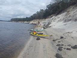
ourselves. We make it to Temple Landing
and it has a nice boat ramp and places that looked like you could stealth
camp in an emergency. We push on and come to the place Dave had picked out using
Google Earth for a campsite. It is on
a pretty high bluff and nowhere to pull up our kayaks unless we empty them
and tediously pull them up one at a time.
We decided not to camp here.
Around the corner is a golf course and Dave says “Lets camp here” but
was overruled. There were still some
people playing but there was a No Trespassing sign at a place where we could
have pulled in. I would have camped
here and pleaded emergency if approached. Anyway,
we paddle on and kept crisscrossing the river every time we see a clump of
pine trees because we know that means dry land. Each time the ledge was too high and it would have been difficult to
make camp at those locations.
The shoreline is now all marsh with occasional pine trees. Craig looks at his GPS and we realize that
now we are only a few miles from highway 17 so that is the plan. We
reach highway 17 just after 5pm and see the current ripping in our
favor. We knew that the river rises 5
feet here due to the tides but were amazed that the tide affected the river
this much at 26 miles from the coast. We
unload our kayaks as much as we can on the very muddy bank next to a boat
ramp and carry our stuff to a dry spot a little walk from the ramp. We were tired but happy to find a place to
camp. We set up, eat
dinner and had beer that we re-supplied when we
shuttle or vehicles. That night we
heard the highway noise and a few trucks drove down by the ramp but no one
bothered us. They probably didn’t see
us because we had brought all our stuff and kayaks into an adjoining field. It was a good paddling day. |
Morning at camp
Dave’s Bell’s Palsy settled in
Searching for a campsite
Hwy 17 – at last!
Camp alongside of Hwy 17 |
|||
|
Day 6
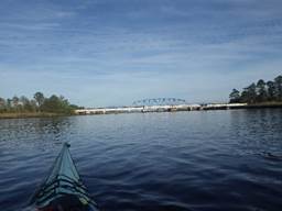
– 17 miles, Feb 21, 2023 There
was a discussion about getting up at 2am and paddling to the City of St Marys
in the dark so we could paddle with the current. Dave really didn’t like the idea and he is
usually the one who suggests a night paddle.
Not knowing the area and the large swings in the tides made hime
uncomfortable. It was decided to wait
until daylight and start paddling as the current ebbed. That was a very good decision. We had
not accounted for the tides at the city of St Marys – we were looking at the
charts for close to where we were so we would have missed the favorable
current and been floating around in the dark with no place to get out because
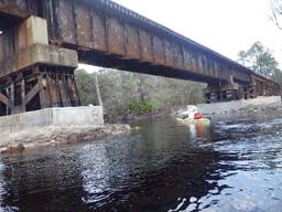
it is all marsh after highway 17, except for where I-95 crosses and a
bluff. Be mindful of the tides in the
area you are in AND where you are going – there was at least a two-hour
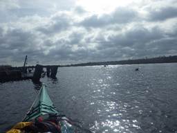
difference. We get
up knowing we will start paddling around 10 am so we are relaxed, eat and
pack leisurely. We decide to have a
post breakfast beer – it was good and we are not alcoholics! We
launch just before 10am with some wind but we know the current will be with
us. 17 miles to go today. It took us forever to get to I-95 even
though as the crow flies it was very near.
The river has numerous bends in this area and made it more like a
6-mile paddle which seemed longer with the wind and winding turns through the
marsh. I-95
would have been a suitable place to camp but there was a lot of trash there
and I suspect homeless individuals reside there often. The next stop was a bluff around 5 miles
east of 95 which looked like it would be a neat place to camp if we could
have tied our kayaks up and climbed up the west side. It looked like it would work. Very
wide river at this point and more like open water paddling. We had good current and enjoyed the added
push especially with the windy conditions.
Still interesting but we did miss the intimacy of a narrower river. We
paddle on and make it to St Marys with a fairly leisurely paddle interrupted
by strong winds. We are a day early
because we didn’t find a campsite a few days ago and pushed on, so we booked
a campsite at a KOA for the night. Craig
and Dave shuttle the vehicles – drive to St Marys Fishcamp and then back to
the city of St Marys. Then we pack up
and drive to a local KOA that is nearby. The KOA
campground was a pleasure (with showers!) and they had a swimming pool and
putt-putt golf as well as other amenities.
The only drawback is that the KOA is right alongside of I-95 and gets
the traffic noise. It didn’t bother us
though – we really liked having a nice place to wind down after our trip. |
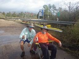
Post-breakfast beer
Launch time
I-95
Along I-95 possible campsite
Bluffs around 5 miles east of I-95
Approaching St Marys
We made it! |
|||
|
Days 7
and 8 Feb 22/23, 2023 No
paddling We
spent day 7 exploring the KOA, playing putt-putt, and enjoying the pool. We went into town for lunch and after lunch
Craig had to get on his way for a family event in South Carolina. Stew
and Dave relaxed and then went out for dinner at a local barbeque. Then back to the KOA where they had a
rustic Cabin for the night. Just
relaxed, talked and watched old tv shows.
Rockford files comes to mind. The
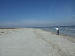
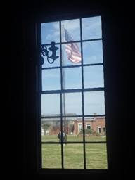
next day, Feb 23 Stew and Dave drove to Ft Clinch where they had a campsite
reserved for three nights. The weather
was extremely warm and neither wanted to spend the night in tents. They decided to drive home after exploring
Ft Clinch and both said they want to go back with
their wives to explore the area and go to Cumberland Island. Ft
Clinch is a really nice park and it was only $2.50 to enter and explore the
fort. We were going to kayak to
Cumberland Island but with Dave’s condition, the wind, and the heat, we
decided that will have to wait for some other time. Conclusion: This
was another great trip with an added medical issue that could have been
disastrous. Dave decided to just push
on (due to circumstances – no cell service and far away from help and ego)
but that could have been a fatal or crippling decision. We are all in denial when something major
happens to us like a stroke or heart attack.
Seek medical assistance immediately! This is our
advice at water level 3.2 to 4.2 feet as measured near Macclenny,
FL:
The
first 60 miles of the St Marys River that is covered
in the paddling trail guide we recommend for intermediate and above paddlers
only due to downfall. In low water,
canoes could be a lot more difficult since kayaks float a little higher. Lack of places to camp after Scott’s
Landing make it a long 30-mile day to Hwy 17 or 36 miles to I-95 to
camp. Tides affect the river a lot at
Hwy 17 and east so that should be taken into account
if you plan a trip. Have fun! |
Playing putt-putt golf at KOA
KOA camp
Ft Clinch beach combing
Ft Clinch fort |
|||
|
|
||||
|
Resources: As
always, we used Google Earth to scout the areas and measure distances
before our trip Google
Maps to look for outfitters, places to launch, places to park
vehicles, etc We
found St Marys Cove, St Marys
Fishcamp, Knuckleheads Kayak Adventures St Marys River Guide: St. Mary's River
Paddling Guide (floridadep.gov) St Marys Fishcamp at Scott’s
Landing: www.stmarysriverfishcamp.com St Marys Cove: stmaryscove.com Knuckleheads Kayak Adventures in St Marys - Jerry was very helpful with info -
Google to search
for info on the areas and other paddler’s advice/experience City
of St Marys website: Visit St.
Marys & Cumberland Island GA - Home (visitstmarys.com) St Marys Riverkeeper (she was very helpful): stmarysriverkeeper.org |
||||