|
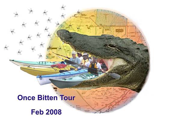
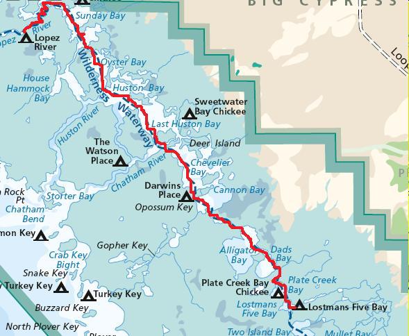
Everglades
National Park Wilderness Waterway Kayak Trip
February 15 – 22, 2008
TRIP
REPORT
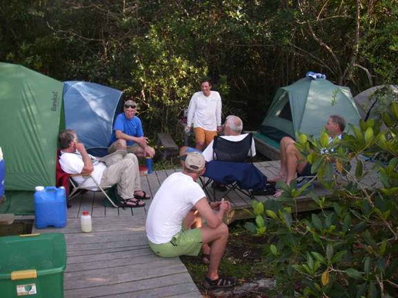
Our group consisted of three: Tom who drove over 1700
miles from Wisconsin, Stew who
lives in Palm Beach county, FL
and Dave who also resides in Palm Beach County,
FL.
We had done two previous trips – one two years ago (February 2006)
across Florida from Sanibel Island to the Atlantic Ocean via the Okeechobee
Waterway (165 miles in 7 days) and last year (February 2007) we did the
entire Suwannee River from Fargo, GA to the Gulf of Mexico at Suwannee, FL
(235 miles in 8 days) – that was a great trip (must do it again). We decided upon the Everglades
National Park’s Wilderness
Waterway because we’ve read so much about it and we wanted Tom from Wisconsin
to see one of the wildest parts of Florida.
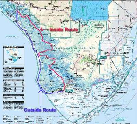
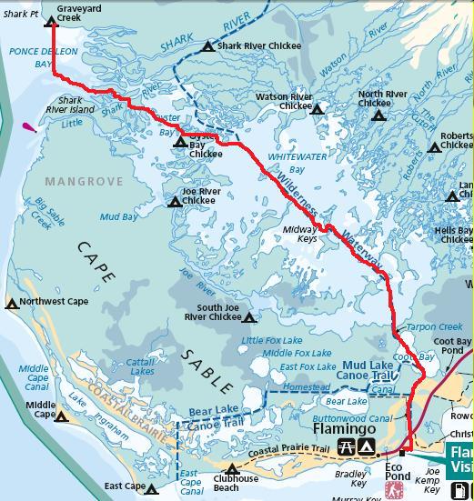
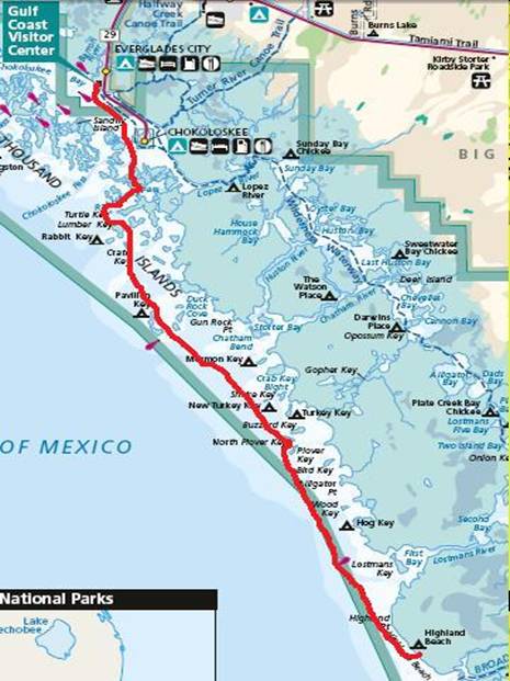
The route began in Everglades City and tracked the Wilderness Waterway “inside route” to Flamingo then
returned via the “outside route” along the Gulf.
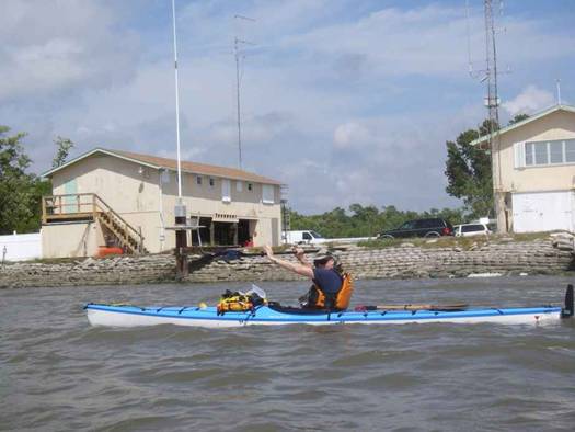
Day one Feb 15,
2008, Stew and I drive together from Boca
Raton, FL to Everglades
City. We eat breakfast at the Triad restaurant –
it was a very neat place to eat, right on the water. We ate outside in a screened room that goes
out over the water. Then we drive to
the Gulf Coast Ranger Station in order to secure our campsites for the next 8
days. We wanted to be one of the first
in line when they opened at 8am.
I was nervous about not getting one of the campsites on
our list since I really didn’t have any alternatives in mind. I was relieved when the ranger said “Yes,
it’s available” to every campsite and date we requested. As we were finishing up in walks Tom, our 3rd
member who drove all the way down from Merrill, Wisconsin – over 1,700 miles!
We anticipated him getting in early but not until noon or so.
This was great because I had cancelled our in-town reservation and
booked the Lopez River
campsite which is an 8-mile paddle from the ranger station in Everglades
City. We walked around the area for a little
while and perused a few stores, then decide it was time to get our adventure
underway.
It took a while to get our kayaks all packed up. No matter how many trips we go on, the
stuff just doesn’t fit well the first time we pack! That’s why Stew and Dave always bring a
spare dry bag for overflow. Tom is
usually good at getting it all packed in.
Almost Ready!!
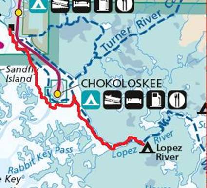
Finally we’re off! We’ve been anticipating this trip for a
long time. The 8-mile paddle from Everglades
City to our first campsite at Lopez
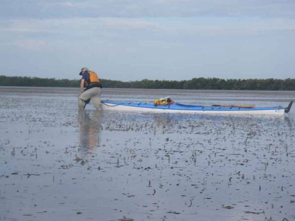
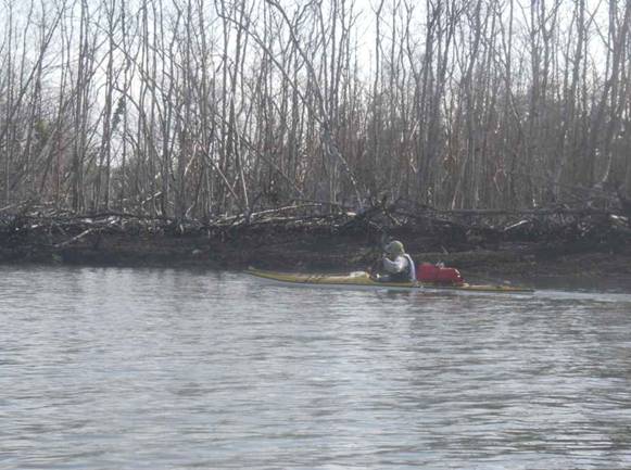
River campsite is pretty routine except for picking our way around the oyster bars
near Chokoloskee Island. They are big and could do some major damage
to our kayaks.
Day One Friday, February 15, 2008 – 7.8
miles
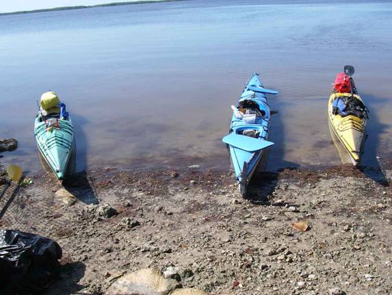
Stew, Tom, and Dave at the Lopez River campsite

Lopez River
campsite is small but an easy paddle up the Lopez
River. It has remnants of a cistern and a few nice
places to pitch a tent. We met a
father and his four sons who were out on a multi-day canoe trip. Very nice family. We were lucky that there were few bugs out
on our first night. . We made dinner and watched a beautiful sunset as fish
jumped and dolphin came by in search of food.
Day Two: Arise at 5
am, cook and eat breakfast.
As we are loading the kayaks we notice a bunch of small green glowing
things in the water. They look like
fire flies in the water! When we
picked them up they are actually small globs of jelly – I believe a type of
jellyfish. This was great because
we’ve heard and read about this but had never seen them. Pretty neat stuff.
Day Two Saturday, February 16, 2008 – 19.4
miles
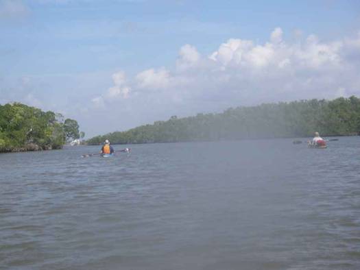
We paddle through many mangrove islands that all look the
same while watching for the next Wilderness Waterway marker. Dave has the charts, compass, and is also equipped
with much of the markers and campsites loaded in his GPS. Tom was also prepared with individual
charts he printed out and his new GPS loaded with all the key points. We make a game out of spotting the next
marker. Every time someone says “Marker!”
someone else yells out “Polo!” Lame,
but fun.
There are few places to get out and stretch since most of
the area is mangrove islands. The
“small bays” on the charts sometimes aren’t so small and can be 1 to 3 miles
across.
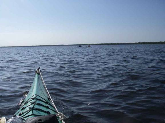
Crossing a small bay
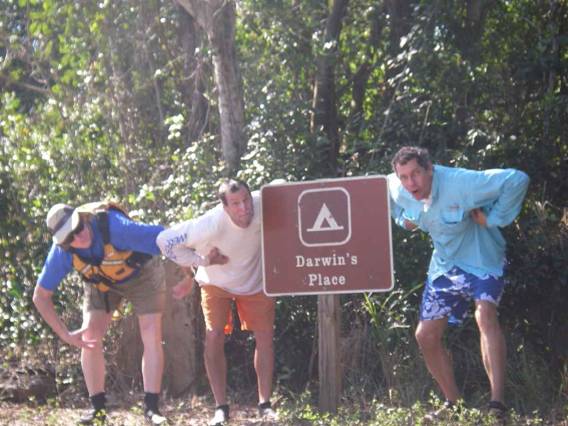
Stop for lunch at Darwin’s place where Tom has a great idea for a
photo op:
After just over 19 miles we make it to our destination for
night two which is Lostman’s Five campsite. There was already a group of five men there
who were also out on a trip. They had
canoes and were having good luck catching all the trout they wanted just
around the corner in a narrow channel.
The campsite has two 12 by 16 foot platforms to camp on since it is
notorious for being wet and like all the islands out there, is forested with
mangrove trees that protect the camping area.
We really enjoyed this site for ease of camping and getting our kayaks
in and out. We had a clear sky that
night and someone commented “I’ve never seen so many stars!” That is something I always look forward to
when camping away from the city lights.
The noise that night with 8 tired men snoring probably
scared away most of the wildlife except for the rats we saw scurrying
around. Be careful when camping,
raccoons are a nuisance but the rats will diligently gnaw though anything as
they did with the canoeists’ dry bags.
The narrow areas were most enjoyable
Lostman’s Five campsite
Day Three: Launch around 6:30
am in the dark. My
favorite time to be paddling is when the sun is coming up.
Beautiful sky looking out over Two Island Bay.
Day Three Sunday, February 17, 2008 – 22.5
miles
We got real good at spotting the markers and had a good
paddle day. The winds were pretty
brisk as they were for most of our trip.
When we made the turn into Broad River we figured it would be nice to
have the current with us but we were wrong, Even though low tide at the mouth of
the river at the Gulf was around 11:30 am, we fought the current all the way
to the camp site – from around 11 am until our arrival around 1:30 pm. As we arrived, I think the current had just
stopped and was getting ready to change direction. An experienced boater we met at the campsite
told us he has never really figured out the currents going into the back
country – really dependent on the winds and moon phase.
Arriving at Broad River camp site.
Broad River campsite is great if
you have a power boat but is not friendly for canoes and especially
kayaks. The camping area is nice and I
think this would be a great spot to spend several days –if you were in a
motor boat. At low tide the ramp is 3
to 4 feet out of the water and it isn’t wide enough to pull most canoes
through anyway. Us
kayakers went to the other side of the dock to find nasty mud and a steep
bank but that was our only choice. It
was tough at high tide and plain stupid at low tide the next morning when we
launched at 5:30 am
Day Four: Up at 4:30
am, pack up, heat water for oatmeal, eat, pack the kayaks and
we’re off or not. Like I said it was a
nasty launch site (now it was low tide) and we took our time getting the
kayaks into the water in the dark and dealing with the very slippery, deep
mud. Stew fell once while we were
carrying my kayak but gallantly fell underneath it and let the thing land on
his hip. Nice guy and lucky he didn’t
get hurt.
Day Four
Monday, February 18, 2008 – 29.3 miles
It was extremely dark but we could just make out the sides
of the river. As we approached the
Gulf coming out the Broad River, my GPS said to make a
hard left but we didn’t see an opening so we continued in the river. We came to a dead end where it got very
shallow. Very frustrating being lost
in complete darkness and disoriented because we can’t see very far. We could hear the Gulf and knew it was
right there but we couldn’t get to it.
We turned around and I saw what looked like a way out so I said I
would scout it. I came to a spit of
land that was very narrow but the Gulf was just on the other side! As I was looking for any opening I heard
that awful crunch, grind, then my kayak comes to a dead stop. I hit a bad oyster bar and knew it did
damage to my kayak. I slowly backed
out and didn’t feel any water coming in so that was a good sign. We continued backtracking and found a bend
and low and behold, we finally see the Gulf and head out into it. I guess we didn’t want the trip to be too
easy.
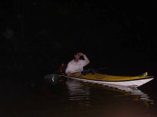
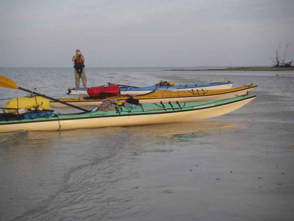
Stew at 5:45 am – pretty dark out!
We had 3 different routes to choose from this day. Route one was direct to our next campsite –
Graveyard Creek – around 10 miles.
Route two was to Harney River Chickee and then back out into the Gulf
to Graveyard Creek – around 17 miles.
Route three (the one I secretly wanted to do) was around 29
miles. We decide to commit to route
two and make a decision once we reach Harney River Chickee.
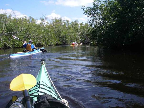
The waterway started to narrow and became more interesting
but as it kept on getting more narrow, we all became concerned. I checked my GPS and we were exactly where
I thought we should be so we continued.
It got so narrow and overgrown that at one point, we couldn’t turn our
18-foot kayaks around even if we wanted to.
This was a pretty cool part of the river.
It was low tide and we were riding over roots and fallen
trees in a very narrow waterway that left no other way but to just try to go
over whatever was under the water.
Sweating and cursing we trudged our way though that
mess. We were getting slapped
in the face by branches that when bent would fly back at you once it left
your paddle. They were amazingly
rubbery. Sticks and branches would
poke us from all angles and get our heads, shoulders and arms while our
kayaks would get stuck on logs and roots – yes, we were still enjoying
ourselves most of the time.
I had to stop several times because branches hooked
through my bungee chords and deck lines and pinned me. Finally we broke though to the other side
and it became less narrow. I can’t
imagine what the “nightmare” route must look like if this was the good
area! This made the day’s paddle a lot
more interesting even with the difficulties it presented. I was glad we encountered it – especially
when we made it out the other side!
Broad Creek gets very narrow and very
difficult to navigate at low tide.
When we get to the Harney
River chickee I paddle up to it
and look at it wondering how the heck would we have
used it with our kayaks. It was four
feet above us with a wood ladder with barnacles on it. Just then the water right in front of me
starts bubbling and wooosh, whooosh, brown mud is being boiled up to the
top! Something large is right next to
me and it starts coming right for me.
I let out a little helpless scream, well let’s call it a yell (real
men don’t scream) and whatever it was goes right under me leaving me rocking
side to side. It had to have been a
manatee or some kind of sea monster…
Stuff like that happened throughout our trip to Stew and I and never
to Tom. Big fish would just explode as
you paddled over them sometimes whapping our kayaks and scaring the heck out
of us. Especially heart pounding when
it occurred in the dark.
Stew and I agreed to abide by whatever Tom wanted to do as
far as route when we got to the chickee.
We were all tired and it was a windy day and the currents had been
against us so far. Tom says “Let’s do
the long route” and my heart jumped for joy because I really wanted to hit
all the markers for the Wilderness Waterway.
I was also weary due to lack of sleep and the amount of effort this
trip was taking out of me. We all felt
the same way. Tom said “This trip is a
lot harder than last year” – we did the entire Suwannee River last year at
235 miles in 8 days but it was cold out and we had current with us the whole
way. Stew was a trooper – he was also
tired and having to do a little more work because his kayak did not have a
rudder.
Although I was happy with the decision to keep on the
“righteous” path I must say that at the point where I knew we still had 12 or
more miles left I was feeling mighty depressed. We stopped for lunch and then I felt much
better – must have needed the energy boost after all that
struggle. Of course when we turned the
corner and expected to have a free ride out to the Gulf in the Shark
River, the current was once again
against us even though we knew the tide was falling and it should have been
pulling us out. The winds also kicked
up a few notches and it made for a long day.
If we stopped paddling we would come to a stop pretty quickly and
start drifting backwards. We were
still having fun but didn’t know it at the time! Tom kept saying “Look! The tide must have
reached its peak and will start falling now” but we could see the leaves and
ripples along the mangrove roots that told us the current was still against
us.
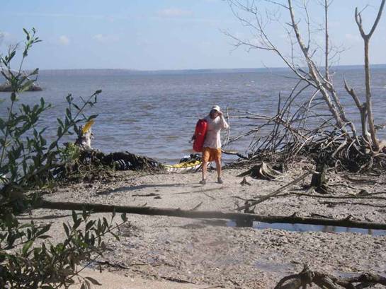
We make it out the Shark
River just as the current ebbs
and then we have a 3-mile paddle across Ponce de Leon Bay to get to Graveyard
Creek campsite. Stew was having
difficulty trying to keep his rudderless kayak on track with strong winds and
2 foot chop both quartering from behind. We make it, tired and beat. At least the wind kept the bugs down to a
minimum – that area is known for having a lot of no-see-ums. This campsite is pretty neat because it is
along the Gulf but also near the waterways that lead inland. It feels like a beach campsite but is
designated as a ground campsite. If
you arrive or depart at low tide, you may have problems negotiating through
the mud flats. We set up camp, cook
dinner and hurriedly head to bed because we have another adventure planned!!!
Stew walking up to Graveyard Creek
campsite after a rough 29-mile day.
Day Five: Tom’s Birthday!! Number 59.
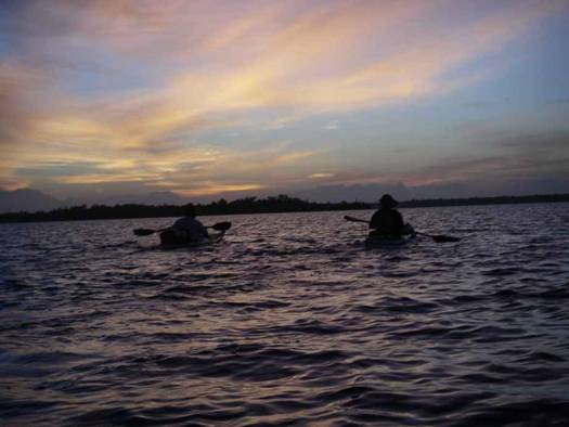
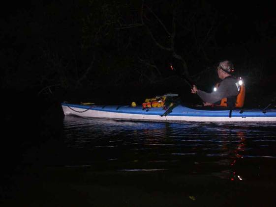
Up at midnight and Stew and Dave sing “Happy Birthday” to
Tom while loading the kayaks for an all-night paddle via Whitewater
Bay to Flamingo. We were worried about the winds but they
seemed to be tapering off and Tom gives us the go-ahead. Again Stew and I decide to abide by Tom’s
judgment and Stew said “You’re kidding, right?” as Tom and I get up and tell
him it’s a go. Stew did not want to do
the length of Whitewater Bay
in those winds (remember he does not have a rudder) from yesterday and surely
did not want to attempt it at night under windy conditions. As it turned out, it was a great decision
to go.
Day Five
Tuesday, February 19, 2008 – 25 miles
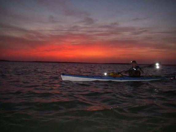
We launch at 1 am
and paddle across Ponce de Leon Bay.
We had nearly a full moon but it was cloudy that night and we didn’t
get much help from the moon. We
paddled with our headlamps on and I had to leave mine on red lamp so I could
see the map and GPS – the white LEDs reflected too much off of my GPS case.
Once we were underway we noticed the wind was dying down
significantly. We paddled close to 3
miles south across Ponce de Leon
Bay and entered Oyster
Bay through one of the many rivers leading in from the
Gulf. Around 2 am it is still very dark (darn clouds!) and as we
make it into the open Bay we hear a very loud snap! bang!
and I am very concerned because it came from the
rear of my kayak! I had run over
something and it retaliated by slapping the rudder section of my kayak – very
hard. I asked Stew to check to see
that my tail section was still in one piece and it took some time for my
heart to stop pounding. Never saw what
hit me but someone suggested maybe it was an alligator or crocodile and it
had hit me with its tail.
Stew and I continued getting surprised by large fish
exploding as we came upon them. We
kept hoping it would also happen to Tom but I don’t think it did. When you’re out there in the middle of
absolutely nowhere, in blackness, and something big hits your kayak or stirs
next to you, I can tell you it gets the juices flowing! I also had several smaller fish jump onto
my kayak and one even got stuck on my kayak skirt – I almost got it but it
slipped out of my hands.
We were following a course I had set on my GPS and used
before that would take us by Oyster Bay Chickee and then hit all the markers
leading us through Whitewater Bay
and eventually into Coot Bay
and the Buttonwood canal to Flamingo.
It was a neat feeling being out on such a dark night but also very
eerie. We could barely see the
outlines of islands and the distant red light flashing at the Flamingo cell
tower every now and then. We noticed
that same light is flashing white in the day time – had us
confused for a while.
This is all we could see – and that was
with a flash!
We make it to Oyster Bay Chickee around 3 am and were trying to determine if anyone was
there. We finally got close enough to
see a boat and then we could hear people talking in their tent. If it were me on the chickee I would have
been pretty nervous hearing someone or something in the water at 3 am.
We decided to leave them in peace and headed for Whitewater
Bay. My GPS was perfect as far as getting us to
the markers. It felt real good to
shine our headlamps and see a marker a tenth of a mile away and then paddle
right by it. Much to the chagrin of my
fellow paddlers, I found that I get vertigo when paddling at night with no
visible target to paddle towards. I
kept turning left, right, and the wrong way while trying to follow my GPS and
compass and causing Tom and Stew to say many times “Are we supposed to be
turning now?” I finally pulled up my
rudder so I would quit over-steering and that helped a lot.
We are making good time and are happy with our progress as
well as the lack of wind and good weather but we are noticing that it is
getting darker – if that was possible.
At one point we turned off our headlamps and you couldn’t see the front
of your kayak! It started to sprinkle
a little and we could see these huge shadows of clouds moving in and blocking
out what moon light there was. The all
of a sudden FLASH! KABOOM! Lightning and we’re 8 to 10 miles from
shore. I hate lightning and to be in
the middle of a huge bay where you are the highest point didn’t make me feel
any better. On the positive side, when
the lightning lit up the sky it was awesome to see islands and land masses in
the distance as clear as day but then they would disappear as fast as they
appeared. I guess we had lightning for
maybe an hour and that made for stressful paddling especially when we
couldn’t see anything in the darkness that enveloped us.
The sun finally started showing as we made it into Coot
Bay near 7 am. The
lightning was gone and a new day was dawning.
Cloudy and overcast but still a beautiful sunrise which was a little
more special this day. We made it to
the marina at the end of the Buttonwood
Canal just before 8 am.
We were thrilled but also getting chilled – a cold front was coming
through. We carried our kayaks to a
grassy area and promptly walked to the marina store and washed up in the
men’s room. Then we got some hot
coffee – yummy. The guy who worked at
the marina offered to ferry our kayaks to the camping area with their truck
and we were very thankful- we would have had a long portage and another mile
of paddling to get there. We had to
wait for a nasty squall to come through – the last before the calm, cooler
weather behind the front. They told us
they had very bad weather in Flamingo all night – we couldn’t believe how
lucky we were to have been in Whitewater
Bay – just 5 to 10 miles away
with only a hint of bad weather.
We set up camp around 10:30
am at the Flamingo campground in the area I thought was group
B. Of course after we were done
setting up the park ranger comes by and tells us we missed it by maybe 50
yards and had to move. We were very
tired but accepted our fate with a happy attitude. Tom was taking a shower at the restrooms
which were very close – part of the reason for choosing this site. When Stew and I walk up to take our showers
a few minutes after Tom got back, the door to the bathroom was locked. A worker told us there was a break in the
water main and they had to shut off the water. I asked if they could turn it back on for
30 minutes and they said “sorry.” We
laughed it off because we just were having too much luck with the ride to the
campsite and such. The next bathroom
was about a quarter mile away and heck, we needed more exercise anyway.
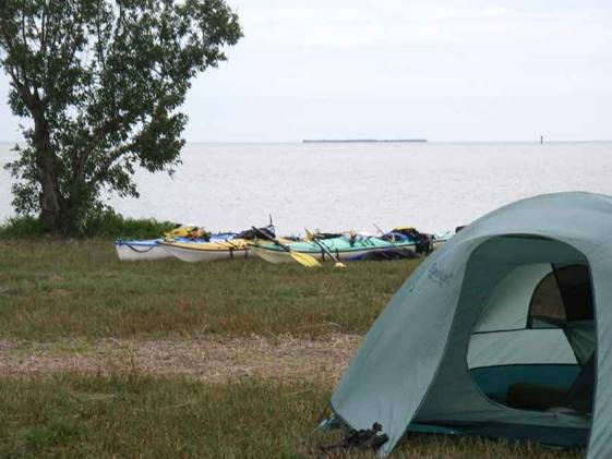
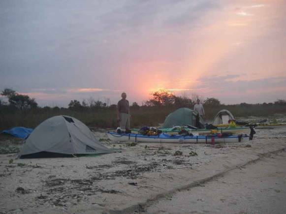
Flamingo Campground
We made several walks to the marina store for snacks and
dinner – it is around a mile one-way but we had all day anyway. It was nice having down time. We did a proper celebration of Tom’s 59th
birthday complete with a musical candle, brownie cakes and presents. Then it was time for bed by 7 pm.
No one stirred until after 7 am
the next day. It was the best night
for sleeping due to the cooler weather which only lasted that night and part
of the next day.
Day Six: In the morning I notice that I can see a
white glowing line when looking into my kayak’s cockpit from the morning
sunshine reflecting through the bottom.
I didn’t want to know but found out after our trip that it was where I
had hit the oyster bar when trying to find a way out of the Broad
River in the dark. It cut
through the gel coat and lightly frayed the kevlar cloth – pretty easy repair
but if I had hit a little harder…
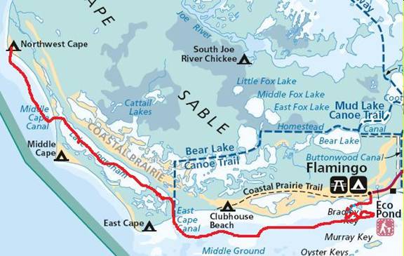
Day Six
Wednesday, February 20, 2008 – 21.4 miles Note squiggly line
near Flamingo where we got stuck in the mud then headed back looking for
Stew.
This is going to be our first easy day – late start and
leisurely paddle. I suggest we go out
the marked channel so we don’t get stuck in the mud. The Flamingo area is notorious for its mud
bars and it is no fun trying to push or pull yourself
through that muck. Of course Stew says
“Let’s go this way” along the shoreline between Bradley Key and shore. I knew better and even told him that if we
get stuck it is all his fault. So guess what? We get stuck in the mud. Not just a little stuck but you could feel
that mud sucking onto the bottom of your kayak and literally see the water
still going out. In an hour we would
be on dry mud. I panic and get out and
start sloshing through the mud. Tom
did the same but what became of Stew?
He turned back and got stuck several times but finally made it out the
channel which we should have taken anyway.
Tom and I made it out after about 20 minutes of hell in the mud. That gets your heart a thumping! We didn’t
see Stew for quite some time so we paddled back towards the marina in the
deep water and met him as he was making the turn from the channel. Together again at last.
Tom in the Mud near Flamingo – ughhhh!
It was yet another windy day with 2 foot plus chop washing
over us from the rear. I started to
surf some of the waves and was having fun with it and even got some long
rides that paid for all the effort I was expending on trying to catch
them. We stopped at Clubhouse
Beach for a break. Clubhouse beach is a campsite but doesn’t
have a lot of area to set up a tent.
It is also very buggy in the warmer months – a nice place to stop but
I’d recommend camping at a beach site more open to the wind. There is a prairie behind the beach and it
was very green and picturesque. We got to see a Bald Eagle up close when it
landed in a tree close to us. That was
neat. Every day on our trip had
something special happen that made the trip more memorable.
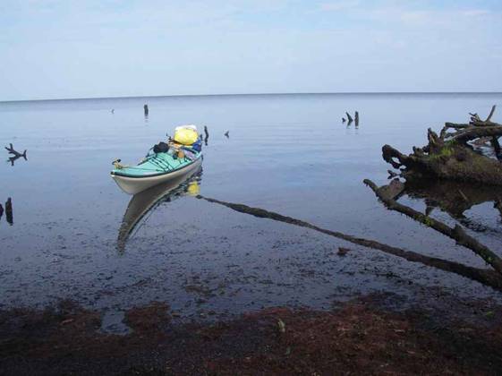
We decided to take Lake Ingraham to get out of
the wind and chop but also because it is a neat place to paddle through. We hit it just right and the tide pushed us
into the East Cape Canal
and towards Lake Ingraham. We saw some guys on a boat with something
big pulling down a rod. They said they
thought it was a shark but we didn’t hang around to see what they pulled
up. The winds were reduced drastically
and the current was with us for a change.
Lake Ingraham
has a narrow waterway with markers to show you the way. It gets very shallow and large areas that
were underwater at high tide become mud flats at low tide. Lots of birds come here for food during low
tide. We saw a flock of what seemed
like thousands of wrens turning all in unison. As we got closer you could hear the noise
from the thousands of tiny wings.
Another cool thing.
We eventually emerge out of Lake
Ingraham just north of Middle
Cape Sable and our timing was good because we hit the tide at or near
ebb. The current can be so strong as
to prevent paddlers from getting out and I’ve heard stories of them getting
“sucked in” and having to wait for the tide to change before being able to
paddle back out. We paddle along the
coast which looks like it was hit by a bomb and/or up north in the winter time
when the trees have lost all their leaves.
This is due to the hurricanes of the past several years – the trees
(especially along the shoreline) were bent by the winds did not recover. I’m sure the water from the storm surge
also contributed to their state.
Somewhat barren but pretty shoreline
We made it to Northwest Cape Sable
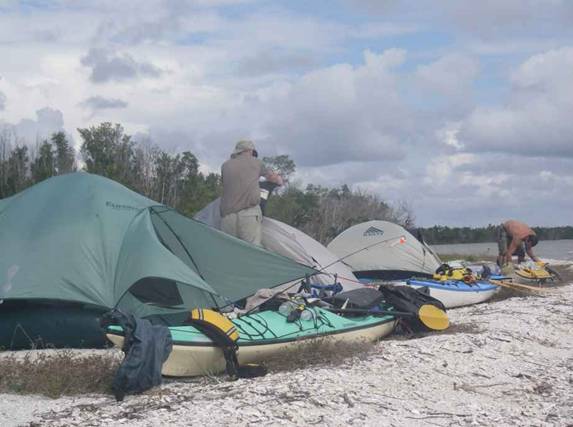
around 3:30 pm. This campsite is a nice beach campsite that
does not leave you stranded at low tide.
It was still very windy with clouds overhead so we put a tarp down in
a gully that runs the length of the beach between the higher sand bank and
the interior of the cape that is filled with shrubs, trees, and green ground
cover. This gave us enough protection
from the wind so we could cook. All of
us prepared our own meals, cleaned up, sat around and talked for a while and
then off to bed. Didn’t get much of a
sunset with all the cloud cover that evening.
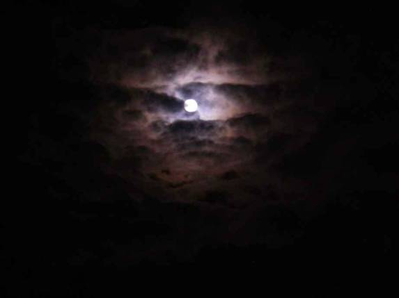
Day Seven: Up at 5 am
and it is dark but with the clouds breaking up we could see the moon peek out
every so often. It was just like in
one of those werewolf movies – how the moon would appear and then
disappear. We were treated to a
splendid sunrise however. That’s the
kind of thing that helps you remember why you are out there in the first
place and you wish you could share that feeling with others.
Moon at 5 am
Sunrise at NW Cape Sable
Day Seven
Thursday, February 21, 2008 – 19 miles

No rush and we leisurely launch by 8 am after making breakfast and I was out fishing for
an hour. We didn’t have any luck at
fishing on this trip but this area is full of fish if you fish at the right
locations. Our destination today is Highland
Beach and we decide to take a
straight route across Ponce de Leon Bay.
A lot of paddlers have told me they won’t cross that bay in windy
conditions but we didn’t think it would be too bad. Had chop occasionally braking over our
kayaks so we all had our skirts on as well as our pfds. Stew tended to hug the coastline to keep
out of the wind.
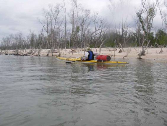
Stew passing more dead trees that line
the water’s edge
Break time out of the wind
We get to Highland
Beach around 1:30 pm at high tide which was very good because at
low tide you can’t get to the beach. There
are mud flats that can go a quarter mile out at low tide and the mud there is
the nasty kind that sucks your feet and legs down and is knee to thigh
deep. It was so windy that we lined
our kayaks sideways along the beach and placed our tents behind them. I had to tie my tent to my kayak because it
kept collapsing in the strong wind.
Stew and Tom have better tents than I and theirs did okay.
Highland Beach
Tom and Stew erected a wind break so we could cook and get
out of the wind. It did feel nice to
duck behind it for a break. Also made
dinner easier to fix and eat. It was
an especially easy dinner for Stew and I because Tom said “I’ll make dinner
for everyone” – no argument from us!
After dinner a couple strolled up – they were camping for
4 weeks or so with a sailing canoe.
Very nice people from Ohio
who have the winters off due to the nature of their business in
construction. We were all envious of
their being able to be off for such a long period of time. They told us that that area has deer and
other animals that walk along the beaches.
We didn’t see any but you could see their foot prints.
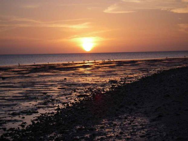
That evening we were treated to a spectacular sunset and
we all watched for the “green flash” that we’ve heard about. As the last of the sun disappeared below
the horizon, we watched, but no green flash.
Others we met at Lostman’s Five campsite said
they saw it when they were on the coast.
Oh well – still a nice way to end the day. I think Highland
beach would be one of my favorite campsites especially if I was going to
spend a few days out there.
Sunset at Highland Beach – note the mud flats that protect the beach
Day Eight:
Before we went to bed we noticed how far out the water went at low tide and
figured the next low tide was going to be around 8 am so we planned to be
under way before having to sluff our kayaks through the mud. Loose plan was to get up around 4:30 am but if anyone was up before then and
noticed the tide getting low to sound the alarm. As it turned out, both Tom and I were up
around 2 am and both of us put a
marker at the water line. At 3 am again, we both looked out and saw the
water about a foot from the markers so we decided it was time to get
moving. It didn’t feel bad because it
is hard to sleep while camping and we get to bed very early anyway.
Day Eight
Friday, February 22, 2008 – 31 miles
Tom mentioned that if we were making good time that maybe
we could skip the last night planned for Pavilion Key and end our trip a day
early. It was a great idea because we
got to go home early but also the days were getting warmer – even hot - and
we would avoid a sweaty night. It is
always neat to be paddling in the dark knowing that the sun will be coming up
soon. We launched close to 4:20 am and paddled for 2 hours before seeing
the sunrise around 6:30 am. We paddled the first hour and a half aiming
toward a red blinking light on a buoy – that helped me to keep a straighter
line since without a fixed point I tend to be all over the place. Once we got closer to the buoy we made a
turn to stay somewhat closer to the coast although we were pretty far out
most of the time trying to go in a straight line to Pavilion Key.
We were once again rewarded with a spectacular sunrise –
there is nothing like seeing the sunrise when you are out in the water on a
very dark night. By 7 am we make it to our first stop for a break at North
Plover Key. There are two islands –
North Plover Key and Plover Key. We
could see that the tide was going out because our kayaks kept getting higher
out of the water where we had beached them.
The sand bar was nice because it was actually sand and not mud. There were all sorts of little mollusks and
shells scurrying along. We picked up a
few and were pleased to see snails in them – we usually see crabs (not the
original owners) or they are empty when you find them nearer to populated
areas. We also found a bunch of
bleached-out sand dollars – some of which I collected and hope to preserve
with a fiberglass coating since they are very fragile.
Sunrise along the Gulf
Break at North Plover Key
We were making great time and got to Pavilion Key at 10 am.
The last mile was very tough because the tide was still going out a
little and our route took us between some islands which made the currents
flow stronger in the channel we were in.
I was hot and took a dip but had to be careful because there was mud
just off the beach and it again was the nasty kind that goes up to you thighs
if you try to stand in it. The cool
water was very refreshing though. We
see that the tide has stopped and is reversing so we are happy and decide to
do the final push for home – Everglades
City – around 11 miles more.
The tide is with us and we get good current as we paddle
toward the maze of mangrove islands that hide Chokoloskee
Island and the rest of the
mainland. I had been here before and
used my map and compass to navigate – no need for my GPS but I kept it
handy. We stop at Turtle Key for our
last break and enjoy the white sandy beach and the view of the mangrove
islands in the surrounding area. Again
we set off and finally, we see Chokoloskee
Island through the islands! The current is well with us now and we are
cruising – at one point I looked at my GPS and it was reading 7.2 mph as we
were rounding a corner of Chokoloskee!. We had to be very careful as we approached
Chokoloskee because of the oyster bars so we followed the markers for the
boats once we exited the maze.
We can See Chokoloskee
Island!
Next stop is Everglades
City where we had begun this
odyssey 8 days previously. Tom and
Stew seem like they are in a race – they are paddling so fast due to the
excitement of finishing. I say “Hey! Why are we racing?” and they slowed down a
bit. I was glad because I was tired. Very tired.
We arrive at our destination at 12:45
pm to find numerous cars, trucks, and trailers full of people
going out in canoes and kayaks.
Luckily we hit a lull and we got our kayaks up and our vehicles backed
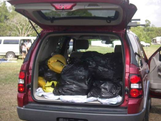
down so we could off load the kayaks and load up the trucks. Stew and I marveled at how we got all that
stuff that filled the back of his truck into two kayaks.
Tom in celebration pose at Everglades
City – Gulf Coast Ranger Station
Truck load of “stuff”
We get all of our stuff packed up and the kayaks secured
on the top of the trucks then go clean up as best we can in the men’s
room. We all had brought a change of
clothes. Now for our victory lunch at
the Triad restaurant in Everglades City. It was a great meal – not only because we
were hungry but it is a good place to eat.
After lunch Stew and I said our goodbyes to Tom and we parted – Tom
began his 1700 mile trek back to Wisconsin
and Stew and I drove back to Palm Beach
county at less than 150 miles.
Tom and Stew at lunch
It was a great trip
with great friends/athletes that come together for these special
occasions. It was also a lot of work –
we didn’t know how hard it would be dealing with the tides and wind but
especially the heat factor. We are
very happy to have done it but for now on we will plan any marathon type
kayak trips in more northern areas that have cooler weather! Maybe the Suwannee
River again. I know in a month or so I could be talked
into a 3 or 4-day trip back to that area but winter is slowing moving out and
I would not go down there in the summer with the heat and bugs. Maybe next winter… My advice to anyone thinking of doing any
part of the Wilderness Waterway is to do it!
Just know your limitations and be safe. Maybe do a few smaller routes and build up
if you want to do the whole thing. If
you have the luxury of more time that would also be helpful – we do these kind of trips in a compressed timeframe due to our limited
vacation days since we are in the “working class.”
|