|
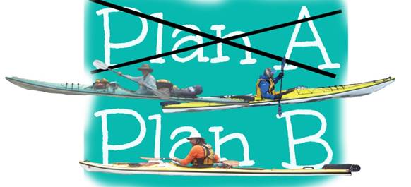
Ochlockonee River Change of Plans
Tour Feb 15 – 22, 2020
We were to do the Apalachicola River
again but due to
extreme high water and flooding we did the Ochlockonee River. It turned out to be a great change
of plans! |
||
|
|
||
|
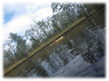
Our trip was on the
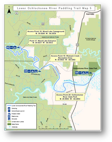
Ochlockonee River and we started 25 miles west of Tallahassee, FL on FL 20
where FL 20 crosses over
the river and ended near the Gulf of Mexico.
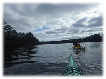
Paddlers: Dave B, Stew, Dave Sea
Kayaks: Seda Glider, Current Designs
Solstice, Current Designs Solstice GTS (same order as paddlers) Trip
Conditions: Temps low to mid
70s daytime; cloudy, rain a few days, 50 - 60s night, 30s on our last
night. The weather was great being
overcast and cool - except for the rainy parts that weren’t too terrible. Meals: We each brought our own meals – some better
than others! We learn a lot from
watching what other people bring and do on trips. You can make gourmet camp food if given
some thought. Snacks: nutrition bars, beef jerky, apples,
oranges. Water: we each had at least 5 gallons each in 16.9
oz bottles,some liter containers and water bladders. Beer: Yes. |
||
|
|
||
|
The Tuesday before our trip (we are set
to leave Saturday at 4am) the lockmaster calls me and says that the
Apalachicola River is at flood stage and he doesn’t know if he can lock us
through. We were to start in Lake
Seminole, lock through to the river and continue to the Gulf of Mexico. So I asked if we could put in at a
boat ramp a little lower down the river.
He then explains to me that we will get killed if we attempt to kayak
the river at the current water levels.
There are large trees and dead cows floating in the swift
current. I asked a bunch of questions
and he became exasperated at me and said “You’re not listening. If you attempt to kayak the Altamaha River
you will be F’n killed!” Okay, I was convinced. So I texted Dave and Stew and we were
looking at alternatives. We were
looking at some rivers we already did and not very happy about it. Dave Briggs (Dave B) said he found a river
called the Ochlockonee in the same area.
He made more calls and was told it is okay to paddle - even with water
levels being a little high. So change
of plans. Dave put in a couple of days
of quick planning, calling and making reservations, and saved our trip. Thanks again Dave! |
|
|
|
|
||
|
Day 1 Saturday, Feb 15, 2020 We all drove up from south Florida to
25 miles west of Tallahassee, FL – about a 7 hour drive. Stew and Dave drove up from the east
coast while the other Dave B (actually both Dave’s are Dave Bs) drove up from
the southwest coast. We met at the Riverfront RV and Campground which is where FL 20
crosses the Ochlockonee River – perfect place to start. The owner, Nader was very nice and let us
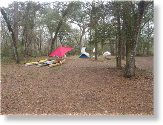
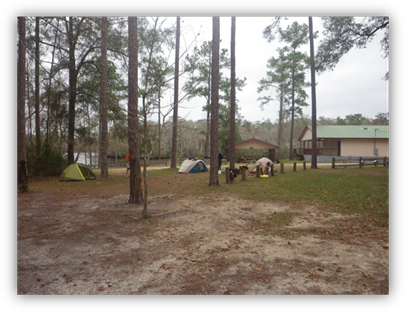
camp next to the boat ramp. . |
||
|
|
||
|
We set up our tents and then the two
Daves shuttled one vehicle to our take-out point in Ochlockonee River State
Park – around an hour drive one way.
Along the way they saw fires – the park service was doing controlled
burns. We hoped that it wouldn’t
affect our trip and it didn’t. For dinner we drove to a food truck
just down the road that served Greek (I think) food. It was good. Nice to still have our vehicle and of
course we had bought some IPA beer to go with dinner. Weather was pleasant in the low 70’s with
forecast of rain and 50’s for the evening.
We had a nice fire going and talked to some locals. The fire was very nice as it turned cooler. |
|
|
|
Day 2 Sunday, Feb 16, 2020 17 miles to
Huey P Arnold boat ramp Dave B brought supplies to make us
all a hardy breakfast for our first morning.
This was doable because we had a vehicle with us at the starting point
and could leave the cooking stuff and ice chest in the car. He did a great job and there is nothing
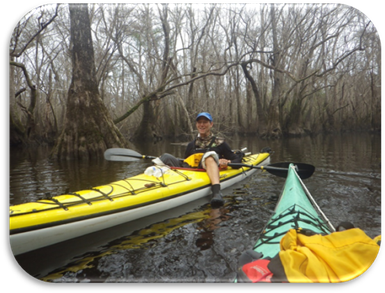
like a nice hot meal on a chilly morning on the river. The first day of paddling was cloudy
and it rained on and off with steady light downpours. It made us chilled but we were prepared
with rain tops and layers. We paddled
up to the CH Corn Hydroelectric Generating Station – a dam that separates
Lake Talquin from the river and then into the rushing water that turned us
around to begin our journey to Huey P
Arnold boat ramp as seen on Map 2 below. We didn’t see many animals – some
bald eagles at the beginning and an unconfirmed otter sighting. There were oyster shells at all of the boat
ramps and we figured that must be from otters. We saw some otters (confirmed) later on the
trip. |
||
|
|
||
|
Dave B making a hardy breakfast
while Stew devours it.
|
We paddled to the dam (CH Corn
Hydroelectric Generating Station) and into the rushing water.
|
|
|
As we paddled we
each tell stories of past trips and funny things that happened. Dave B told of a trip with a Brazillian friend
who when they accomplished a milestone on a trip proclaimed “We are
mans!” We used that phrase a lot for
the rest of our trip. After a
difficult paddle around and through deadfall someone yells out “We are
mans!” We told lots of
neat stories and funny things but I just can’t remember them now. Dave B said that on hiking trails like the
Appalatian Trail people give trail names.
We made up some porno names and things that would keep other travelers
away. We decided Dave B would be
“Manson” since he kind of resembles the guy! |
||
|
. |
|
|
|
|
||
|
|
||
|
First night on the river was at a
designated camping spot per the river maps we downloaded. Huey P Arnold boat ramp that was right on
the river. We had paddled around 17 miles
– added a few due to exploring and paddling to the dam at the beginning. Stew kept asking how far and since we
didn’t know, the standard answer became somewhere between 12 and 22 miles. Nice, leisurely day. It, as well as all of our camping spots,
had a boat ramp. We were very pleased
with all of our campsites – nice, high and dry. I think all of them were in a state our
county park. All seemed pretty
remote. The rain had stopped for a
while as we set up our campsite. Nice
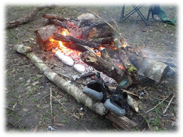
end to day one and we have beer! Of course we made a fire – if you
don’t make camp fires, try it. It adds
so much to the experience. We found
plenty of wood and Stew has this napalm - like fire starter stuff that drips
fireballs until the fire gets going.
Heard some owls during the night, and it rained a little while we
slept but was done come morning. |
||
|
|
|
|
|
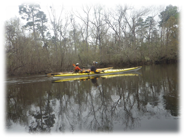
Day 3 Monday Feb 17, 2020 17 total
miles Paddled to Whitehead
Landing Today we had some sun and actually a
little warm for a while. There was some deadfall and current which was
a little alarming at first because our trip a few years ago on the
Withlacoochee River was riddled with deadfall and current and we had to do
emergency maneuvers all day. Not on
this trip. There was
just enough obstacles to keep it interesting and make you pay attention.
To get to camp we paddled up a fork
from the main river; went past the first campsite and on to a camp site near
a bridge. Paddled up-current; eventually found the spot heavily
occupied and literally right under a bridge so we paddled back to first spot
we saw which was Whitehead Landing – it actually is the second landing on the
map, access point 8. This was a good
camping spot. |
|
|
|
|
|
|
|
Lunch Break
|
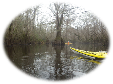
We had to maneuver
in the current to avoid deadfall. Sometimes we
weren’t as successful as we wanted to be.
|
|
|
The campsite was
another nice place to camp. Stew
brought some potatoes so we had baked potatoes as a treat. Dave B presented some cheese and we rolled
it up in the potatoe skins for another treat! At dusk, we were
sitting around making our dinners and we saw a bat flying overhead swooping
and eating insects. Always cool to see
bats but you have to be watching for them just before the sun goes down. Not sure if it was this camp night but we
heard a pack of coyotes howling and we presumed going in for a kill. It got a little noisey there for a
while. We weren’t really worried but
it did sound like there were quite a few of them in the woods. |
||
|
|
Baked potatoes in
the fire – yum!
|
|
|
|
|
|
|
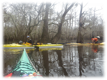
Day 4 Tuesday Feb 18, 2020 14 miles Paddled to Hitchcock
Lake Campground Today was another almost perfect day
with it being overcast. Scenery first rate
and the company the same. A 14-mile
paddle with current is what we consider a very light day and something I
think our future trips will embrace.
In the past, we always wanted to do big days with big miles but now we
are starting to enjoy the stress less days of getting up whenever we wake up
and leisurely starting our day. To get to the campground we had to
paddle upstream on a
tributary and though a cypress tree forest. At first, there are little yellow arrows
attached to trees but when you really needed one, nothing. Of course we went the wrong way when we got
to a fork in the river but we were rewarded for our efforts with some really
cool views and large trees. It was as
if we went back in time to prehistoric days. |
|
|
|
Getting ready in
the morning
|
We’re off!
|
|
|
This was the
coolest campsite to paddle up to.
|
Prehistoric looking
area with large cypress trees
|
|
|
We met Rudy fishing at the boat ramp
which seemed in the middle of nowhere.
He was having a good time just relaxing and fishing. Said he comes here often and catches a lot
of fish. We had a long walk from the boat
ramp to where we camped. Sluffed our
stuff up the hill and when the kayaks were reasonably empty, we carried them
up too. We didn’t want to leave them
at the boat ramp in case someone came down and was launching a boat. It would have to be a very small boat
because this area is very narrow in the water. The camp site had a picnic table and a
porta john. As with all the other places we see
some oyster shells along the banks and figure it is from otters. Still strange to see oyster shells this far
from the Gulf. There were nice trails
for biking or hiking but we did not walk too far – just wanted to scope out
the area. The camp had several
game-cleaning stations - we figure for deer season. We had another good fire. Another fine
campsite
|
||
|
|
|
|
|
Day 5 Wednesday Feb 19, 2020 11 miles to Woodlake Campground. Today we paddled to Woodlake Campground
so as not to get to our reserved campsite at Womack Creek a day early. This campsite was also great but frequented
more by others due to its proximity to civilization. It has a nice camping area, cement out
house and places for people in RVs to park. We met Sonny who was living out of
his van and he was playing a 12-string Martin guitar. He handed it to Dave who can play barely
good enough to be acceptable around a campfire. He dove right in to “You ain’t going
nowhere” – an old Dylan tune. Sonny
appreciated the tune and was invited to come sit
around the fire with us later that evening. |
|
|
|
|
|
|
|
|
|
|
|
|
|
|
|
|
|
|
|
After dinner when we were sitting
around our fire, Sonny did show up. He
was a kind of “out there” individual who talked about 432 tuning and how Big
Foot came when it heard someone in the Civil War play a violin with 432
tuning. He had mystical rocks you
could hold to gleam some of the energy.
He was fun to talk to and an enjoyable person to meet. He thought what we were doing was
phenomenal – he liked that word. He
and Dave took turns playing songs on his guitar and singing. Stew played several songs too. Sonny was actually very good and said he
played in several bands and played some bars in the past. |
||
|
|
|
|
|
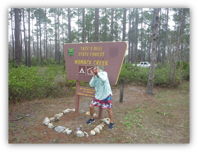
Day 6 Thursday Feb 20, 2020 3.5 miles to Womack Creek Recreation
Area Today was a very short paddle to a
supervised campground (Glenn and Linda were the hosts). When we first arrived we saw Linda who had
caught 20 pan fish ranging from Shellcrackers, to Bluegill, to Stumpknockers;
all of which got fried up for Friday night fish fry. She has a nice boat set-up with a motor and
goes fishing most days. She was very
proud of the fish she caught and showed them to us in a 5-gallon bucket. |
|
|
|
|
|
|
|
Sonny sending us
off with good vibes
|
Only 3.5 miles to
go today
|
|
|
Our site at Womack
Creek campground
|
Located in Tate’s
Hell state forest
|
|
|
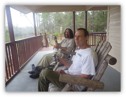
We bought a
six-pack of beer from the camp hosts.
Glenn told us it was his wife’s beer but would let us have it. I told him I didn’t want to get him in
trouble and asked if she (Linda) had enough left after I eyed a large
container containing many empty beer cans.
She had two left but they had to go shopping anyway. Dave B and Stew can
be beer snobs so I wasn’t sure how they would react when I brought back six
Busch beers. Dave B said “Hey, they’re
cold!” They went down with ease and we
enjoyed them on the deck overlooking the river. Due to impending bad weather on the
way, we decided to camp here two nights and abandon our next leg which was to
paddle out in open water to Bald Point, around 19 miles. That was a good choice because later that
day the sky opened up, it got cold and extremely
windy. |
Dave B and Stew
enjoying a cold beer
|
|
|
Day 7 Friday Feb 21, 2020 7 miles to Ochlockonee River State Park We paddled to our take out at
Ochlockonee River State Park. We were
going to paddle out to Bald Point and had reservations for Chaire’s Creek but
the weather deteriorated. So we
decided to stop a day early and spend another night at Womack Creek then head
back Saturday. |
||
|
|
The morning was very windy and in
the low 40’s / high 30’s. We gathered
around Linda’s fire in the morning and went through our options, none of
which included paddling out to Chaires Creek.
So we decided to paddle our empty boats down Ochlockonee State Park;
load up (that’s where we had left one vehicle), get some BBQ for lunch, then
head back to our camp at Womack Creek.. |
|
|
|
|
|
|
|
|
|
|
We loaded up the truck with our kayaks
and headed to the town of Sopchoppy where we had lunch just outside of town
at Hamaknockers. It was a very good
bbq place and Dave said he had the very best bbq beef brisket ever. He isn’t a huge barbeque fan but this may
have changed his mind! If in the area, eat here! Hamaknockers BBQ, 2837 Coastal Hwy,
Crawfordville, FL 32327, USA |
Lunch Photo Op
|
|
|
For dinner, Linda had invited us for
a fish fry – Stew and Dave B declined but Dave said “Heck yes!” He loves a fish fry especially after eating
camp food all week. The fish fry was
delicious and Linda even had hush puppies made that were better than I ever
had at any restaurant. We had a nice fire again supplied by
our camp hosts and we sat around it until time for bed. It was going down to 30 tonight. Stew wore all of his clothes that
included thermal underwear and a mylar blanket and was still cold in his 40
degree sleeping bag. Dave B and Dave
were fine in their down bags. |
|
|
|
|
|
|
|
Day 8 Saturday Feb 22, 2020 Drive Home We awoke on this chilly day and
there was ice on the truck! The
host Linda had a fire going and we again huddled around it and drank our
morning coffee. We were told about a breakfast
place we would pass on our way back to pick up our other vehicle. We never found it and doubt there was one
near since we could not find it on our cell phones and the locals we asked
said there wasn’t any. We did find a
small grocery store that the owner’s wife made breakfast sandwiches each
day. We bought some, had more coffee
and it hit the spot. We made it back to our starting
point, unloaded our gear and placed it on the proper vehicle to start our
journeys home. Dave B was heading to
the southwest coast of Florida while Stew and Dave were on their way to the
southeast coast. We said our good byes and headed
home. Please Read: This is where we usually put the
conclusion and resources but something happened to Stew and Dave on their
drive home which could have end tragically.
They switched drivers every two hours and were in Dave’s Honda
CR-V. When it was Stew’s turn we had
got on the expressway and Stew looked at Dave and asked how to turn off the
cruise control. Dave said “tap the brakes.” Stew said it didn’t work so Dave reached
over and turned off the cruise control.
By this time Stew’s eyes were as wide as saucers and said the brakes
aren’t working and we are accelerating.
“I can’t slow down!!” Dave said
“Stew your foot has to be on the gas!!”
We had no time to look down because we were in traffic and passing
cars. Stew swears his foot isn’t on
the gas pedal and we are both starting to freak out a bit. Just like out of a comedy
movie. 60, 65, 70 ,75 – Dave says
“Stew, get over to the side and I will turn off the engine just one notch so
you will still have steering but no power steering or power brakes.” Now we are up to 85 mph and thank God we
were able to maneuver around traffic.
Dave turned off the engine and we coasted to a safe stop. WTF?
Dave got into the driver’s side and felt something on the right side –
it was Stew’s paddle that is stuck and doesn’t come apart any more. It shifted and went down and pressed the
accelerator to the floor. We had tears
of laughter and relief but it could have been disaster! We’ve both done hundreds of trips
and we are both safety minded but we did not pay enough attention when
loading the car with a long paddle. I
truly believe if it were anyone else it would have ended differently. Please be careful and think about these
things. We do and it still happened to
us… |
||
|
Conclusion: This was a highly enjoyable
leisurely trip for us and something we will continue to do. Get up leisurely, shove off around 9:30 am and
have shorter days (20 miles or less) than many of our past trips. Taking time to smell the roses, relax
without a challenging paddle every day.
We were a great team and got along very well – all mellow and team
players. Stew’s comments: “All-in-all; except for missing Jack
and Sam; one of the best trips I’ve had.
A beautiful river with no one else we saw in kayak or canoe - only a
few boats. Apparently lots of fish
including large Gar and Catfish. Saw 2
deer (one alive); one confirmed Otter, Raccoon, Squirrel, heard coyotes,
owls, saw bats; one bald eagle, osprey.
Lots of great trails for biking and walking. Weather great. Some areas very remote and others within a
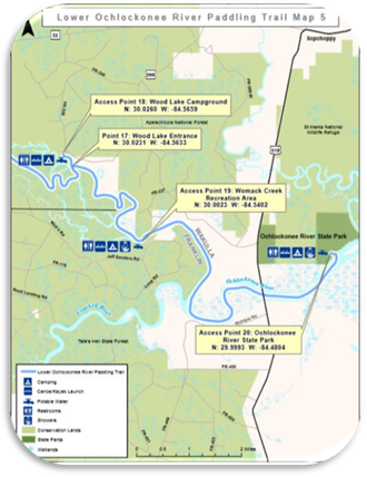
few miles of a town.” Resources: Google Maps Called local parks and
river keepers Found maps on Florida
Paddling Trails government website: https://floridadep.gov/PaddlingTrails PDF of Map : https://floridadep.gov/sites/default/files/Upper_Ochlockonee%20Guide.pdf |
||
|
|
|
|